

Advection Fog
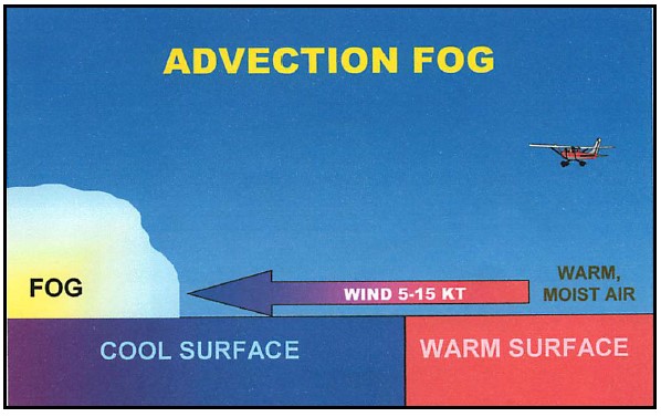
Advection fog forms when warm, moist air moves horizontally (is advected) over a colder surface — land, water, or a surface covered by snow or ice — and cools to 100% relative humidity. It is reported in METARs with the code FG when visibility is at or below ½ SM.
How It Forms
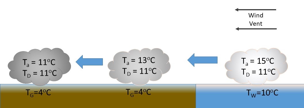
Warm, humid air is moved by the wind over a much cooler surface. The warm air cools from below by contact with the cold surface — a process called conductive cooling. This creates a surface temperature inversion that suppresses vertical mixing, trapping the cooled air near the surface. If the air cools to its dew point, fog forms.
Ideal Conditions
- Warm air with high relative humidity — already close to saturation, requiring only a small temperature drop
- A continued supply of moisture from an upwind water source (ocean, lake)
- A large temperature contrast between the air mass and the underlying surface
- Moderate winds — strong enough to advect the air mass, but not so strong as to cause turbulent mixing that breaks up the fog
Duration and Dissipation
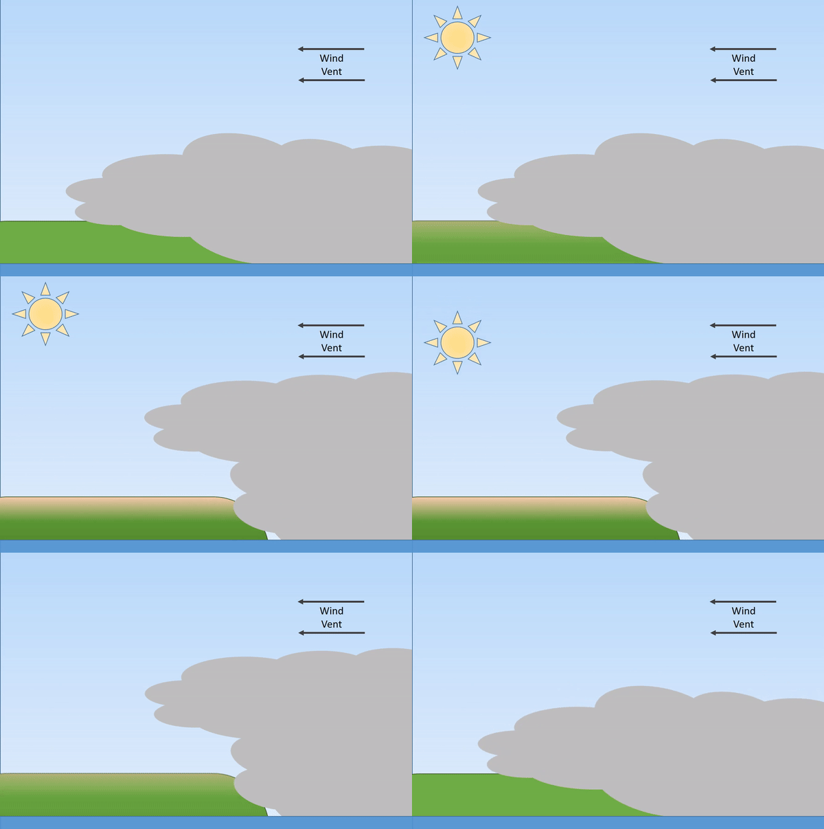
Advection fog can persist for hours or days — far longer than radiation fog. It does not simply burn off with daytime heating. Dissipation requires a change in wind direction that brings drier or cooler air, or wind strengthening enough to cause turbulent mixing through the fog layer.
Hazards
- Visibility at or below ½ SM (IFR conditions) that can persist for days
- Fog layer typically thicker and denser than radiation fog — daytime heating has limited effect
- Potential in-flight icing in winter when fog exists at or below 0°C
- Can appear rapidly as a fog bank advects across a coastline or lakeshore
- Difficult to forecast accurately — onset and dissipation are hard to pin down
Canadian Context
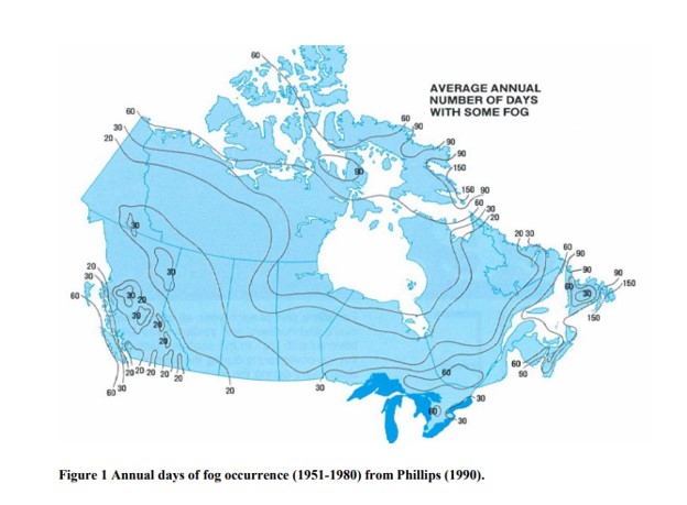
The Atlantic coast — particularly Newfoundland and Labrador — is among the foggiest regions on earth, where the warm Gulf Stream meets the cold Labrador Current. The Great Lakes generate advection fog in spring when warm air moves over cold lake water. In winter, mild southerly air advecting over snow-covered ground produces widespread fog events across southern Ontario and the Prairies.
Reading It in Forecast Products
- METAR: FG when visibility ≤ ½ SM; BR (mist) when > ½ SM but < 6 SM
- TAF: FG or BR in TEMPO/PROB groups, particularly in overnight/early morning periods
- GFA: Clouds and weather panel depicts fog and low ceilings; useful for geographic extent
- AIRMET: Widespread IFR conditions from fog may trigger an AIRMET advisory
On the TC Written Exam
Advection fog is a high-frequency exam topic for both PPL and CPL. Key points: it forms when warm moist air moves over a cooler surface; it can occur at any time of day (unlike radiation fog, which forms at night); it is driven by wind and persists until the wind shifts; it tends to be thicker and longer-lasting than radiation fog.
Related Terms
See also: Advection, Radiation Fog, Icing, Visibility, Ceiling.